


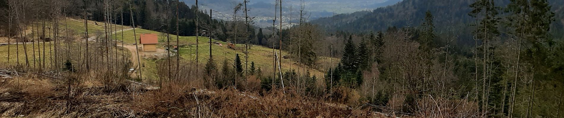
cleurie-la charmes-roches du thin-col du singe

demange gerald
User
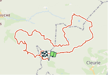

Length
13.6 km

Max alt
778 m

Uphill gradient
521 m
Km-Effort
21 km

Min alt
584 m

Downhill gradient
522 m
Boucle
Yes
Creation date :
2023-02-28 06:58:22.066
Updated on :
2023-02-28 10:26:29.888
3h24
Difficulty : Medium

FREE GPS app for hiking
 SityTrail
IGN / Geographical institutes
SityTrail Plus
The world is yours!
About
Trail Walking of 13.6 km to be discovered at Grand Est, Vosges, Cleurie. This trail is proposed by demange gerald.
Photos


Positioning
Country:
France
Region :
Grand Est
Department/Province :
Vosges
Municipality :
Cleurie
Location:
Unknown
Start:(Dec)
Start:(UTM)
324936 ; 5324849 (32U) N.
Comments