


les woieries2.2023.02.28

trusgnachjf
User

Length
13.4 km

Max alt
472 m

Uphill gradient
301 m
Km-Effort
17.4 km

Min alt
313 m

Downhill gradient
303 m
Boucle
Yes
Creation date :
2023-02-28 12:41:02.493
Updated on :
2023-02-28 16:15:40.575
3h33
Difficulty : Difficult

FREE GPS app for hiking
 SityTrail
IGN / Geographical institutes
SityTrail Plus
The world is yours!
About
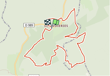
Trail Walking of 13.4 km to be discovered at Grand Est, Ardennes, Monthermé. This trail is proposed by trusgnachjf.
Positioning
Country:
France
Region :
Grand Est
Department/Province :
Ardennes
Municipality :
Monthermé
Location:
Unknown
Start:(Dec)
Start:(UTM)
626609 ; 5529781 (31U) N.
Comments