


PR_22_Caurel_AA_01_Circuit1b_Des-Landes-De-Caurel_20150308

patrickdanilo
User
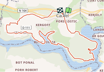

Length
14.3 km

Max alt
239 m

Uphill gradient
311 m
Km-Effort
18.4 km

Min alt
121 m

Downhill gradient
306 m
Boucle
Yes
Creation date :
2023-03-01 09:08:34.008
Updated on :
2023-08-22 14:40:18.185
4h28
Difficulty : Medium

FREE GPS app for hiking
 SityTrail
IGN / Geographical institutes
SityTrail Plus
The world is yours!
About
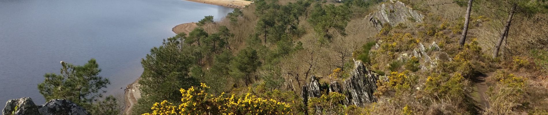
Trail Walking of 14.3 km to be discovered at Brittany, Côtes-d'Armor, Caurel. This trail is proposed by patrickdanilo.
Description
Randonnée Marche de 15,2 km à découvrir à Caurel, Côtes-d'Armor, Bretagne. Cette randonnée est proposée par patrickdanilo
Photos


Positioning
Country:
France
Region :
Brittany
Department/Province :
Côtes-d'Armor
Municipality :
Caurel
Location:
Unknown
Start:(Dec)
Start:(UTM)
497424 ; 5340335 (30U) N.
Comments