


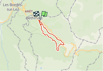
Lac de Bethmale par Ayet

lebarça
User

Length
10.8 km

Max alt
1088 m

Uphill gradient
462 m
Km-Effort
17 km

Min alt
715 m

Downhill gradient
462 m
Boucle
Yes
Creation date :
2023-03-04 13:32:03.0
Updated on :
2023-03-04 17:06:47.173
3h34
Difficulty : Very easy

FREE GPS app for hiking
 SityTrail
IGN / Geographical institutes
SityTrail Plus
The world is yours!
About
Trail Walking of 10.8 km to be discovered at Occitania, Ariège, Bethmale. This trail is proposed by lebarça.
Positioning
Country:
France
Region :
Occitania
Department/Province :
Ariège
Municipality :
Bethmale
Location:
Unknown
Start:(Dec)
Start:(UTM)
341829 ; 4750032 (31T) N.
Comments