


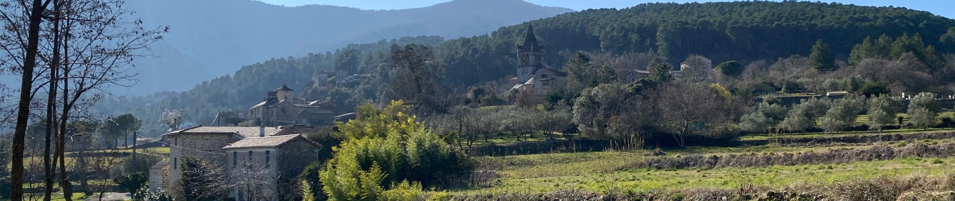
Gravières

Roger Philippe Wallez
User GUIDE
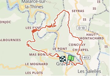

Length
13 km

Max alt
401 m

Uphill gradient
472 m
Km-Effort
19.4 km

Min alt
160 m

Downhill gradient
477 m
Boucle
Yes
Creation date :
2023-03-05 09:04:53.0
Updated on :
2023-03-05 14:22:05.878
5h16
Difficulty : Difficult

FREE GPS app for hiking
 SityTrail
IGN / Geographical institutes
SityTrail Plus
The world is yours!
About
Trail Walking of 13 km to be discovered at Auvergne-Rhône-Alpes, Ardèche, Gravières. This trail is proposed by Roger Philippe Wallez.
Photos


Positioning
Country:
France
Region :
Auvergne-Rhône-Alpes
Department/Province :
Ardèche
Municipality :
Gravières
Location:
Unknown
Start:(Dec)
Start:(UTM)
586885 ; 4919264 (31T) N.
Comments