


boucle Villegly

Mascart
User
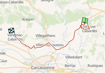

Length
25 km

Max alt
212 m

Uphill gradient
278 m
Km-Effort
28 km

Min alt
96 m

Downhill gradient
293 m
Boucle
No
Creation date :
2023-03-05 13:24:03.751
Updated on :
2023-03-05 16:41:48.901
2h00
Difficulty : Easy

FREE GPS app for hiking
 SityTrail
IGN / Geographical institutes
SityTrail Plus
The world is yours!
About
Trail Walking of 25 km to be discovered at Occitania, Aude, Villegly. This trail is proposed by Mascart.
Description
vers Villard tzel
Positioning
Country:
France
Region :
Occitania
Department/Province :
Aude
Municipality :
Villegly
Location:
Unknown
Start:(Dec)
Start:(UTM)
454507 ; 4792379 (31T) N.
Comments