


ANDELARRE -Mont le vernois- Trou de Jean le fou

nicolasdresse
User
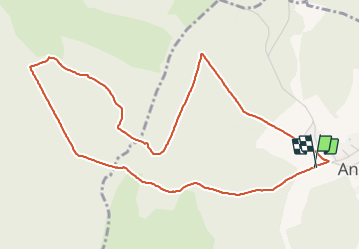

Length
5.5 km

Max alt
414 m

Uphill gradient
141 m
Km-Effort
7.4 km

Min alt
333 m

Downhill gradient
142 m
Boucle
Yes
Creation date :
2023-03-05 16:41:40.0
Updated on :
2023-06-18 14:01:02.612
1h39
Difficulty : Medium

FREE GPS app for hiking
 SityTrail
IGN / Geographical institutes
SityTrail Plus
The world is yours!
About
Trail Walking of 5.5 km to be discovered at Bourgogne-Franche-Comté, Haute-Saône, Andelarre. This trail is proposed by nicolasdresse.
Positioning
Country:
France
Region :
Bourgogne-Franche-Comté
Department/Province :
Haute-Saône
Municipality :
Andelarre
Location:
Unknown
Start:(Dec)
Start:(UTM)
281331 ; 5274818 (32T) N.
Comments