Trail Walking Braux - Rando Pieŕre qui tremble Chabrieres Peloussis Argenton  - Photo

Rando Pieŕre qui tremble Chabrieres Peloussis Argenton

© OpenStreetMap contributors
Length
Length
14 km
Max alt
Max alt
1362 m
Uphill gradient
Uphill gradient
626 m
Km-Effort
Km-Effort  
22 km
Min alt
Min alt
991 m
Downhill gradient
Downhill gradient
631 m
Boucle
Boucle
Yes
Creation date :
2023-03-05 07:55:09.164
Updated on :
2023-03-05 20:12:15.319

(0 Reviews)

Walking
Walking
6h27
Difficulty : Medium

Scan this QR Code to open this trail in the SityTrail application

FREE GPS app for hiking

Logo SityTrail SityTrail

IGN / Geographical institutes

Download SityTrail from the App Store Download SityTrail from Google Play

Logo SityTrail SityTrail World

The world is yours!

Download SityTrail from the App Store Download SityTrail from Google Play Download SityTrail on Huawei AppGallery

About

Trail Walking of 14 km to be discovered at Provence-Alpes-Côte d'Azur, Alpes-de-Haute-Provence, Braux. This trail is proposed by Marchopier.

Description

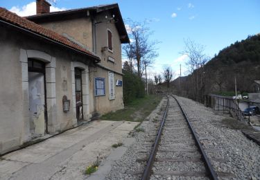
Départ près de la Pierre qui tremble où les véhicules sont stationnés en bord de piste allant de Braux à Chabrières
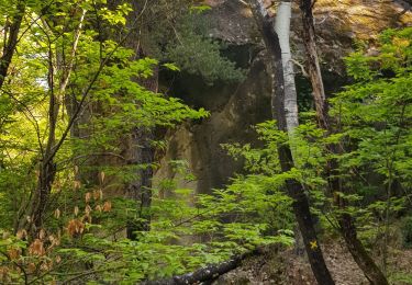
Un sentier rejoint le bord du canal de desserte de Braux depuis le Coulomp, qui conduit au pont de bois franchissant le torrent
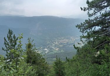
Le hameau de Chabrières est traversé et le sentier monte vers le Haut-Pelloussis
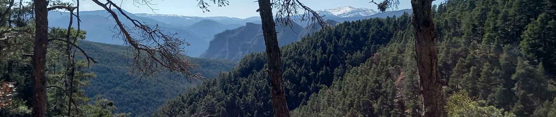
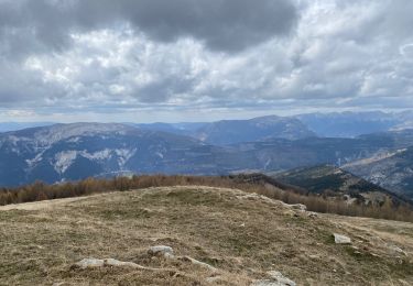
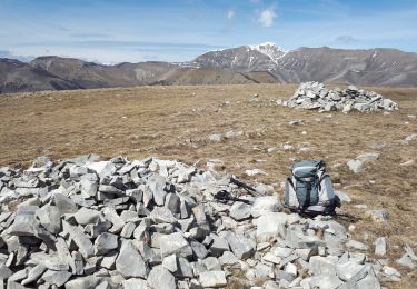
L'itinéraire conduit au Col de Pellousis et atteint les premières barres rocheuses offrant un panorama sur la vallée du Coulomp et les cïmes légèrement enneigées, Mont Saint-Honorat, Pierre-Grosse, Le Grand Coyer....
Le retour se fait par le même itinéraire, prolongé vers La Béouge et Argenton.
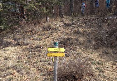
Le sentier du facteur descend vers le GRP Tour des vallées de La Vaïre qui ramène au canal.
Le tracé le franchit et monte dans la forêt rejoindre la piste, suivie jusqu'à la Pierre qui tremble du départ

Elevation profile

Photos

Positioning

Country:
France
Region :
Provence-Alpes-Côte d'Azur
Department/Province :
Alpes-de-Haute-Provence
Municipality :
Braux
Location:
Unknown
Start:(UTM)
314647 ; 4874451 (32T) N.

Trails nearby

Trail On foot Annot - Le Grès d'Annot - Photo
On foot
PRO

On foot

Easy
Annot, Provence-Alpes-Côte d'Azur, Alpes-de-Haute-Provence, France
5.9 km | 10.9 km-effort
2h 28min
Yes
Trail Walking Annot - Rando gastro Roncharel - Photo
Walking
Marchopier

Walking

Medium
Annot, Provence-Alpes-Côte d'Azur, Alpes-de-Haute-Provence, France
5.8 km | 11.9 km-effort
2h 42min
No
Trail Walking Annot - Les grès d'Annot - Photo
Walking
Thierryrando06

Walking

Medium
(1)
Annot, Provence-Alpes-Côte d'Azur, Alpes-de-Haute-Provence, France
11.5 km | 19.2 km-effort
6h 2min
Yes
Trail Walking Méailles - M’égailles tête du Ruch - Photo
Walking
GUIDE
Roger Philippe Wallez

Walking

Very difficult
Méailles, Provence-Alpes-Côte d'Azur, Alpes-de-Haute-Provence, France
19.9 km | 37 km-effort
8h 38min
Yes
Trail Walking Castellet-lès-Sausses - Tête de travers et Mourre Frey, du Col du Fam - Photo
Walking
GrouGary

Walking

Medium
(1)
Castellet-lès-Sausses, Provence-Alpes-Côte d'Azur, Alpes-de-Haute-Provence, France
11.9 km | 24 km-effort
5h 28min
Yes
Trail Walking Annot - Rando bleue - Photo
Walking
Marchopier

Walking

Easy
Annot, Provence-Alpes-Côte d'Azur, Alpes-de-Haute-Provence, France
3.9 km | 5.8 km-effort
1h 22min
Yes
Trail Walking Annot - Grès d'Annot  Carte IGN  3541OT - Photo
Walking
domi06

Walking

Medium
Annot, Provence-Alpes-Côte d'Azur, Alpes-de-Haute-Provence, France
11.3 km | 21 km-effort
7h 23min
Yes
Trail Walking Annot - Les grès d'Annot-20-05-22 - Photo
Walking
Christiancordin

Walking

Medium
Annot, Provence-Alpes-Côte d'Azur, Alpes-de-Haute-Provence, France
6.8 km | 12.4 km-effort
2h 20min
No
Trail Walking Annot - LES GRÈS D'ANNOT - Photo
Walking
michelpaulin

Walking

Medium
Annot, Provence-Alpes-Côte d'Azur, Alpes-de-Haute-Provence, France
5.7 km | 11.1 km-effort
4h 1min
No


Close
My subscriptions