


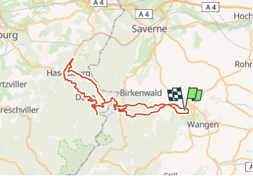
Alsace 2023 / Wasselonne - Parcours 2

bosses21
User

Length
69 km

Max alt
691 m

Uphill gradient
1494 m
Km-Effort
89 km

Min alt
197 m

Downhill gradient
1494 m
Boucle
Yes
Creation date :
2023-03-08 15:01:28.806
Updated on :
2023-03-08 15:18:14.304
5h03
Difficulty : Very difficult

FREE GPS app for hiking
 SityTrail
IGN / Geographical institutes
SityTrail Plus
The world is yours!
About
Trail Road bike of 69 km to be discovered at Grand Est, Bas-Rhin, Wasselonne. This trail is proposed by bosses21.
Description
Col de Valsberg - 652 m
Le Schlossberg - 650 m
Col de la Schleif - 689 m

Positioning
Country:
France
Region :
Grand Est
Department/Province :
Bas-Rhin
Municipality :
Wasselonne
Location:
Unknown
Start:(Dec)
Start:(UTM)
384488 ; 5388310 (32U) N.
Comments