Circuit de la Grande Cascade de Tendon

jeanclaude12
User
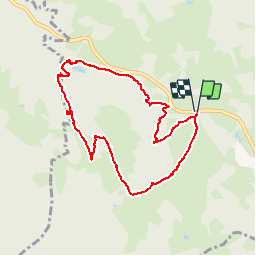

Length
8.5 km

Max alt
736 m

Uphill gradient
251 m
Km-Effort
11.8 km

Min alt
547 m

Downhill gradient
252 m
Boucle
Yes
Creation date :
2014-12-10 00:00:00.0
Updated on :
2014-12-10 00:00:00.0
3h27
Difficulty : Easy

FREE GPS app for hiking
 SityTrail
IGN / Geographical institutes
SityTrail Plus
The world is yours!
About
Trail Walking of 8.5 km to be discovered at Grand Est, Vosges, Le Tholy. This trail is proposed by jeanclaude12.
Description
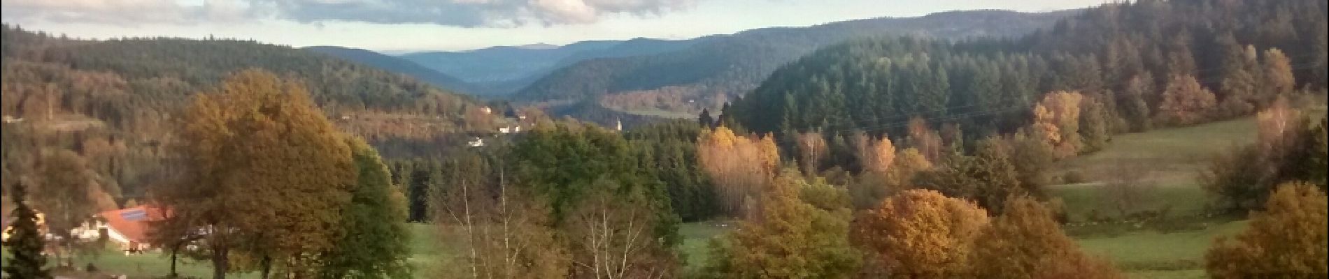
Un peu plus de huit kilomètres depuis le Col de Bonne Fontaine pour se rendre vers le Blanc Faing, la Grande Cascade, l'Infays, le Sapenay et le Gros Caillou.
Photos


Positioning
Country:
France
Region :
Grand Est
Department/Province :
Vosges
Municipality :
Le Tholy
Location:
Unknown
Start:(Dec)
Start:(UTM)
330309 ; 5329310 (32U) N.
Comments