Col de Saint Pierre

ARVIEU
User
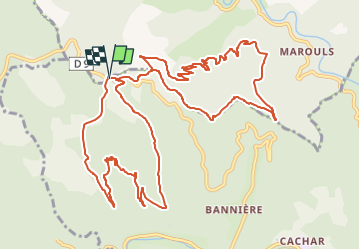

Length
16.6 km

Max alt
632 m

Uphill gradient
804 m
Km-Effort
27 km

Min alt
257 m

Downhill gradient
808 m
Boucle
Yes
Creation date :
2023-03-09 19:33:19.954
Updated on :
2023-03-09 19:48:10.194
5h30
Difficulty : Difficult

FREE GPS app for hiking
 SityTrail
IGN / Geographical institutes
SityTrail Plus
The world is yours!
About
Trail Walking of 16.6 km to be discovered at Occitania, Gard, Saint-Jean-du-Gard. This trail is proposed by ARVIEU.
Description
Pourcentage élevé dans les montées surtout la dernière pour le retour au point de départ.
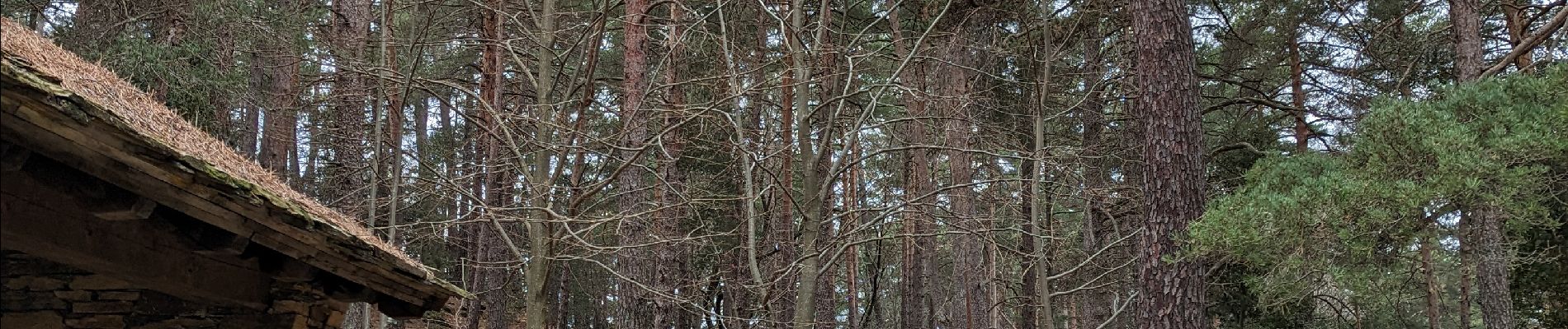
Photos

Positioning
Country:
France
Region :
Occitania
Department/Province :
Gard
Municipality :
Saint-Jean-du-Gard
Location:
Unknown
Start:(Dec)
Start:(UTM)
567144 ; 4887224 (31T) N.
Comments