


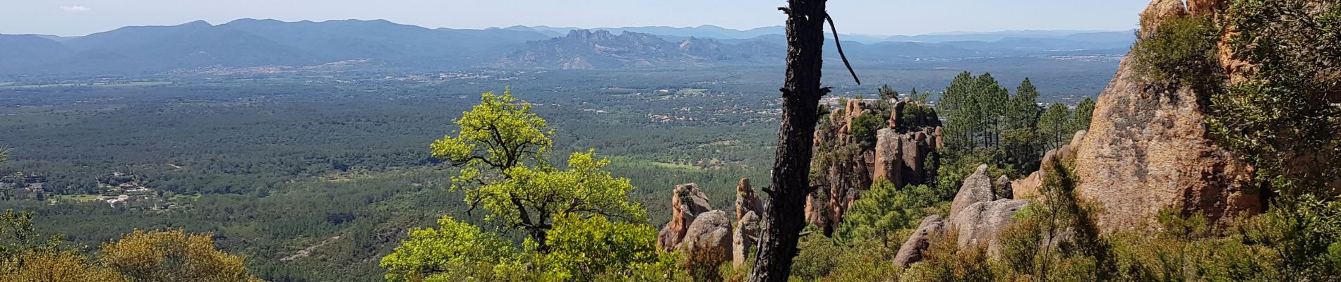
gorge du Blavet

gillou1947
User
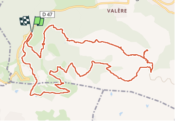

Length
16.9 km

Max alt
419 m

Uphill gradient
575 m
Km-Effort
25 km

Min alt
91 m

Downhill gradient
576 m
Boucle
Yes
Creation date :
2021-05-26 07:39:12.888
Updated on :
2023-03-10 10:07:54.113
6h20
Difficulty : Difficult

FREE GPS app for hiking
 SityTrail
IGN / Geographical institutes
SityTrail Plus
The world is yours!
About
Trail Walking of 16.9 km to be discovered at Provence-Alpes-Côte d'Azur, Var, Bagnols-en-Forêt. This trail is proposed by gillou1947.
Photos


Positioning
Country:
France
Region :
Provence-Alpes-Côte d'Azur
Department/Province :
Var
Municipality :
Bagnols-en-Forêt
Location:
Unknown
Start:(Dec)
Start:(UTM)
310498 ; 4822175 (32T) N.
Comments