


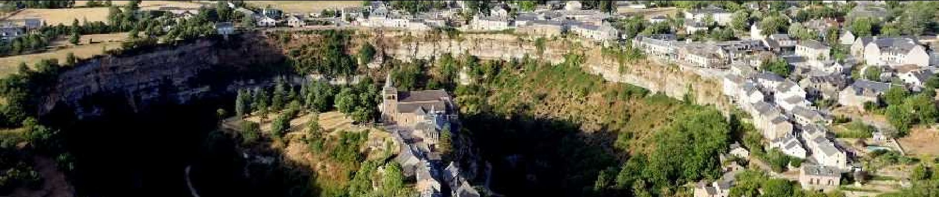
Circuit des passerelles à Bozouls

jagarnier
User GUIDE
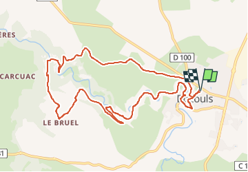

Length
11.6 km

Max alt
552 m

Uphill gradient
355 m
Km-Effort
16.3 km

Min alt
403 m

Downhill gradient
356 m
Boucle
Yes
Creation date :
2023-03-12 09:43:01.416
Updated on :
2023-04-25 07:36:27.407
3h30
Difficulty : Medium

FREE GPS app for hiking
 SityTrail
IGN / Geographical institutes
SityTrail Plus
The world is yours!
About
Trail Walking of 11.6 km to be discovered at Occitania, Aveyron, Bozouls. This trail is proposed by jagarnier.
Photos

Positioning
Country:
France
Region :
Occitania
Department/Province :
Aveyron
Municipality :
Bozouls
Location:
Unknown
Start:(Dec)
Start:(UTM)
477932 ; 4924217 (31T) N.
Comments