


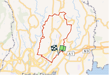
Quartiers Ouest Fort-de-France 972.

Lamartiniere
User GUIDE

Length
11.1 km

Max alt
218 m

Uphill gradient
352 m
Km-Effort
15.8 km

Min alt
26 m

Downhill gradient
352 m
Boucle
Yes
Creation date :
2023-03-12 11:17:22.064
Updated on :
2023-03-14 16:12:14.975
4h00
Difficulty : Difficult

FREE GPS app for hiking
 SityTrail
IGN / Geographical institutes
SityTrail Plus
The world is yours!
About
Trail Walking of 11.1 km to be discovered at Martinique, Unknown, Fort-de-France. This trail is proposed by Lamartiniere.
Positioning
Country:
France
Region :
Martinique
Department/Province :
Unknown
Municipality :
Fort-de-France
Location:
Unknown
Start:(Dec)
Start:(UTM)
709396 ; 1616517 (20P) N.
Comments