


Les Maures-Collobrières-15-03-23

Christiancordin
User
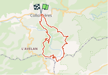

Length
18.1 km

Max alt
600 m

Uphill gradient
624 m
Km-Effort
26 km

Min alt
152 m

Downhill gradient
626 m
Boucle
Yes
Creation date :
2023-03-15 07:47:44.709
Updated on :
2023-03-15 17:55:46.426
4h47
Difficulty : Medium

FREE GPS app for hiking
 SityTrail
IGN / Geographical institutes
SityTrail Plus
The world is yours!
About
Trail Walking of 18.1 km to be discovered at Provence-Alpes-Côte d'Azur, Var, Collobrières. This trail is proposed by Christiancordin.
Description
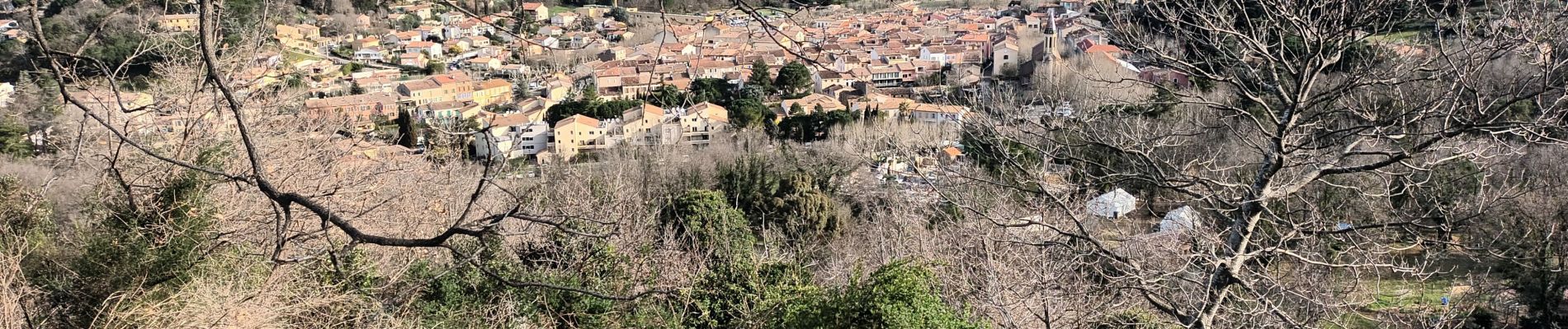
Collobrières-la Haute Malière-piste de la Malière-Peigros-piste du Laquina-GR 90- lave du Desteu-menhirs du plateau Lambert-maison forestière-GR 90-église ruinée.
Photos


Positioning
Country:
France
Region :
Provence-Alpes-Côte d'Azur
Department/Province :
Var
Municipality :
Collobrières
Location:
Unknown
Start:(Dec)
Start:(UTM)
281528 ; 4790833 (32T) N.
Comments