Trail Walking Rochefourchat - Grand Delmas depuis Rochefourchat - Photo

Grand Delmas depuis Rochefourchat

 ajd26
ajd26

User

© OpenStreetMap contributors
Length
Length
16.6 km
Max alt
Max alt
1516 m
Uphill gradient
Uphill gradient
867 m
Km-Effort
Km-Effort  
28 km
Min alt
Min alt
844 m
Downhill gradient
Downhill gradient
872 m
Boucle
Boucle
Yes
Creation date :
2023-03-16 08:16:40.0
Updated on :
2023-03-17 08:56:49.328

(0 Reviews)

Walking
Walking
5h25
Difficulty : Medium

Scan this QR Code to open this trail in the SityTrail application

FREE GPS app for hiking

Logo SityTrail SityTrail

IGN / Geographical institutes

Download SityTrail from the App Store Download SityTrail from Google Play

Logo SityTrail SityTrail World

The world is yours!

Download SityTrail from the App Store Download SityTrail from Google Play Download SityTrail on Huawei AppGallery

About

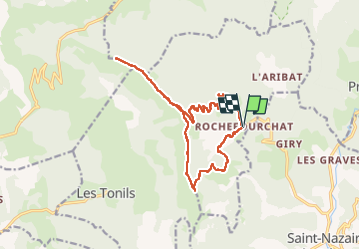
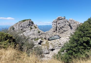
Trail Walking of 16.6 km to be discovered at Auvergne-Rhône-Alpes, Drôme, Rochefourchat. This trail is proposed by ajd26.

Description

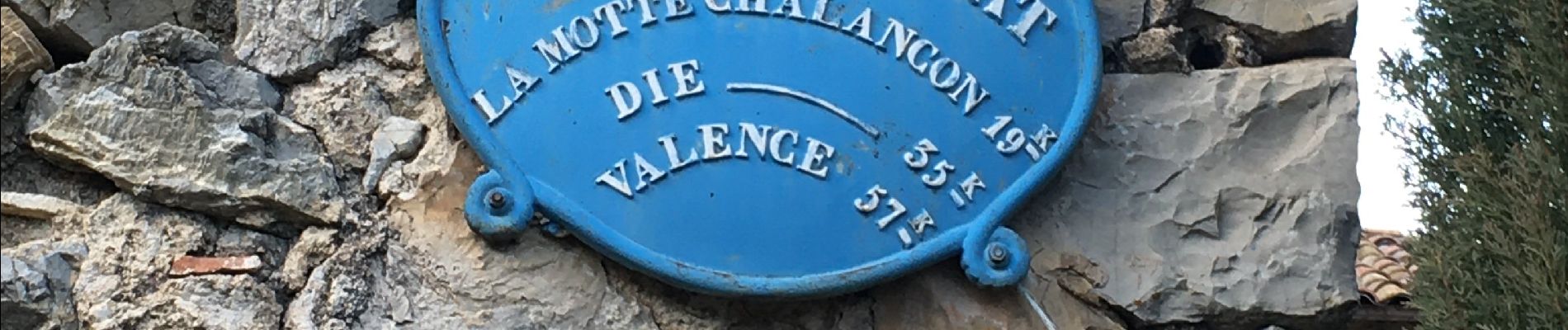
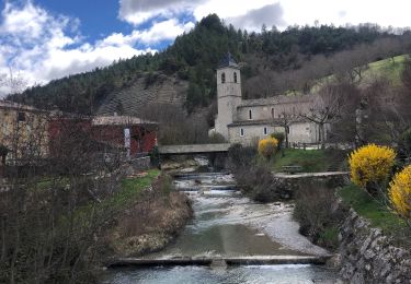
départ de Rochefourchat (vers Pradelle)
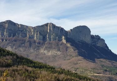
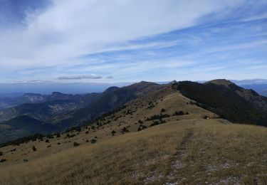
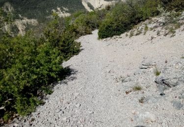
très belle randonnée à faire printemps ou automne avec des panoramas superbes (360°) tout au long du parcours
A/R au Grand Delmas
montagne de Couspeau interdite pendant l'estive
pas de difficultés

Elevation profile

Photos

Positioning

Country:
France
Region :
Auvergne-Rhône-Alpes
Department/Province :
Drôme
Municipality :
Rochefourchat
Location:
Unknown
Start:(UTM)
678293 ; 4940758 (31T) N.

Trails nearby

Trail Walking La Chaudière - Les 3 Becs - Photo
Walking
Noiraude

Walking

Medium
(1)
La Chaudière, Auvergne-Rhône-Alpes, Drôme, France
10.3 km | 21 km-effort
5h 37min
Yes
Trail Walking La Chaudière - La chaudiere - chapelle des Sadoux - Photo
Walking
bob2023

Walking

Very easy
(2)
La Chaudière, Auvergne-Rhône-Alpes, Drôme, France
11.1 km | 18.2 km-effort
3h 47min
Yes
Trail Walking La Chaudière - les trois becs - Photo
Walking
GUIDE
amiral13

Walking

Medium
La Chaudière, Auvergne-Rhône-Alpes, Drôme, France
11.7 km | 23 km-effort
6h 25min
Yes
Trail Walking Saint-Nazaire-le-Désert - Bergerie du Pradaux - Photo
Walking
yvon26

Walking

Medium
(1)
Saint-Nazaire-le-Désert, Auvergne-Rhône-Alpes, Drôme, France
12.5 km | 22 km-effort
4h 42min
Yes
Trail Walking Rochefourchat - Serre Délégué depuis Rochefourchat 15 10 23 - Photo
Walking
bymarc26

Walking

Medium
Rochefourchat, Auvergne-Rhône-Alpes, Drôme, France
14.3 km | 25 km-effort
4h 29min
Yes
Trail Walking La Chaudière - 070823 Boucle des 3 Becs - Photo
Walking
mzonzon05

Walking

Very difficult
La Chaudière, Auvergne-Rhône-Alpes, Drôme, France
11.4 km | 23 km-effort
4h 58min
Yes
Trail Walking Bézaudun-sur-Bîne - Fonderesse - Photo
Walking
AIGUIER

Walking

Difficult
Bézaudun-sur-Bîne, Auvergne-Rhône-Alpes, Drôme, France
13.8 km | 22 km-effort
27h 34min
Yes
Trail Walking Saint-Nazaire-le-Désert - Saint Nazaire le Désert  - Photo
Walking
alinetpierre

Walking

Easy
Saint-Nazaire-le-Désert, Auvergne-Rhône-Alpes, Drôme, France
12.4 km | 21 km-effort
3h 44min
Yes
Trail Walking Saint-Nazaire-le-Désert - St Nazaire le Désert Bergerie des Pradaux - Photo
Walking
Indi34

Walking

Medium
Saint-Nazaire-le-Désert, Auvergne-Rhône-Alpes, Drôme, France
10.1 km | 17.7 km-effort
4h 0min
Yes


Close
My subscriptions