


Le Mont Aurélien et l'Olympe

frizou83
User
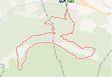

Length
15.2 km

Max alt
874 m

Uphill gradient
677 m
Km-Effort
24 km

Min alt
395 m

Downhill gradient
677 m
Boucle
Yes
Creation date :
2023-03-17 16:08:56.813
Updated on :
2023-03-20 10:16:22.587
5h39
Difficulty : Difficult

FREE GPS app for hiking
 SityTrail
IGN / Geographical institutes
SityTrail Plus
The world is yours!
About
Trail Walking of 15.2 km to be discovered at Provence-Alpes-Côte d'Azur, Var, Pourcieux. This trail is proposed by frizou83.
Points of interest


Positioning
Country:
France
Region :
Provence-Alpes-Côte d'Azur
Department/Province :
Var
Municipality :
Pourcieux
Location:
Unknown
Start:(Dec)
Start:(UTM)
725166 ; 4816312 (31T) N.
Comments