


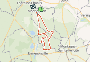
Montlognon MNordique Pierre Sorcière

APhilippe
User

Length
12.1 km

Max alt
133 m

Uphill gradient
175 m
Km-Effort
14.5 km

Min alt
70 m

Downhill gradient
176 m
Boucle
No
Creation date :
2023-03-18 08:25:39.587
Updated on :
2023-03-18 19:17:36.516
0m
Difficulty : Easy

FREE GPS app for hiking
 SityTrail
IGN / Geographical institutes
SityTrail Plus
The world is yours!
About
Trail Nordic walking of 12.1 km to be discovered at Hauts-de-France, Oise, Montlognon. This trail is proposed by APhilippe.
Positioning
Country:
France
Region :
Hauts-de-France
Department/Province :
Oise
Municipality :
Montlognon
Location:
Unknown
Start:(Dec)
Start:(UTM)
477784 ; 5445343 (31U) N.
Comments