


mesnil au val 2023

joebartwix
User

Length
12.5 km

Max alt
155 m

Uphill gradient
135 m
Km-Effort
14.3 km

Min alt
107 m

Downhill gradient
130 m
Boucle
Yes
Creation date :
2023-03-19 08:37:30.53
Updated on :
2023-03-19 11:16:48.279
2h38
Difficulty : Medium

FREE GPS app for hiking
 SityTrail
IGN / Geographical institutes
SityTrail Plus
The world is yours!
About
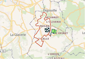
Trail Walking of 12.5 km to be discovered at Normandy, Manche, Le Mesnil-au-Val. This trail is proposed by joebartwix.
Positioning
Country:
France
Region :
Normandy
Department/Province :
Manche
Municipality :
Le Mesnil-au-Val
Location:
Unknown
Start:(Dec)
Start:(UTM)
606586 ; 5495894 (30U) N.
Comments