


hggre

Clo0413
User
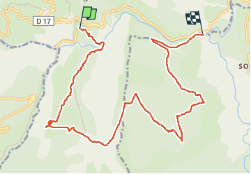

Length
12.3 km

Max alt
1123 m

Uphill gradient
672 m
Km-Effort
22 km

Min alt
624 m

Downhill gradient
739 m
Boucle
No
Creation date :
2023-03-20 08:38:34.891
Updated on :
2023-03-20 15:16:03.559
3h52
Difficulty : Very difficult

FREE GPS app for hiking
 SityTrail
IGN / Geographical institutes
SityTrail Plus
The world is yours!
About
Trail Walking of 12.3 km to be discovered at Provence-Alpes-Côte d'Azur, Alpes-de-Haute-Provence, Rougon. This trail is proposed by Clo0413.
Positioning
Country:
France
Region :
Provence-Alpes-Côte d'Azur
Department/Province :
Alpes-de-Haute-Provence
Municipality :
Rougon
Location:
Unknown
Start:(Dec)
Start:(UTM)
290960 ; 4852166 (32T) N.
Comments