


montagne de Brouis-Bargème-19-03-23

Christiancordin
User
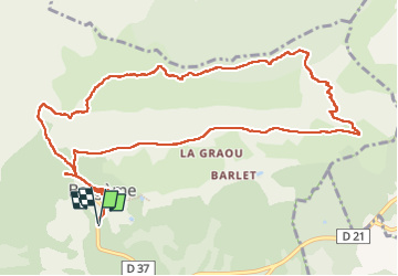

Length
14.3 km

Max alt
1465 m

Uphill gradient
650 m
Km-Effort
23 km

Min alt
985 m

Downhill gradient
649 m
Boucle
Yes
Creation date :
2023-03-20 08:52:00.245
Updated on :
2023-03-22 17:29:29.861
4h24
Difficulty : Medium

FREE GPS app for hiking
 SityTrail
IGN / Geographical institutes
SityTrail Plus
The world is yours!
About
Trail Walking of 14.3 km to be discovered at Provence-Alpes-Côte d'Azur, Var, Bargème. This trail is proposed by Christiancordin.
Description
PK-Bargème-le petit Brouis ( difficile pas de trace)-montagne de Brouis-l'Estang-chemin de la Coustière-château ruiné.
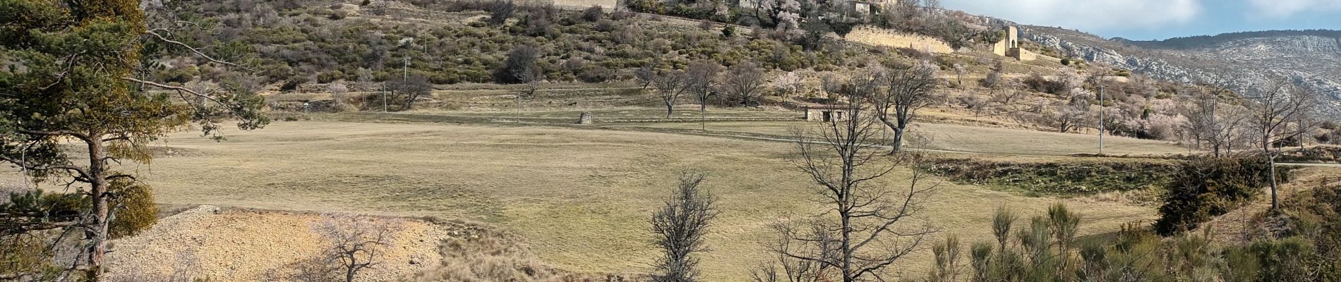
Photos


Positioning
Country:
France
Region :
Provence-Alpes-Côte d'Azur
Department/Province :
Var
Municipality :
Bargème
Location:
Unknown
Start:(Dec)
Start:(UTM)
304446 ; 4844328 (32T) N.
Comments