


Mahiermont

José Leveau
User

Length
4.5 km

Max alt
106 m

Uphill gradient
89 m
Km-Effort
5.7 km

Min alt
57 m

Downhill gradient
89 m
Boucle
Yes
Creation date :
2023-03-12 13:11:04.796
Updated on :
2023-03-21 12:42:21.642
1h23
Difficulty : Easy

FREE GPS app for hiking
 SityTrail
IGN / Geographical institutes
SityTrail Plus
The world is yours!
About
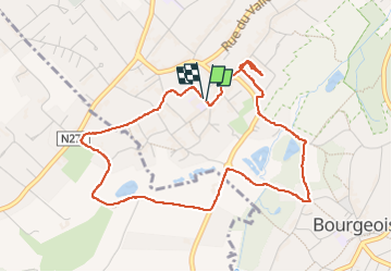
Trail Walking of 4.5 km to be discovered at Wallonia, Walloon Brabant, Rixensart. This trail is proposed by José Leveau .
Positioning
Country:
Belgium
Region :
Wallonia
Department/Province :
Walloon Brabant
Municipality :
Rixensart
Location:
Genval
Start:(Dec)
Start:(UTM)
605760 ; 5619219 (31U) N.
Comments