


Plateau Lambert 2

frizou83
User
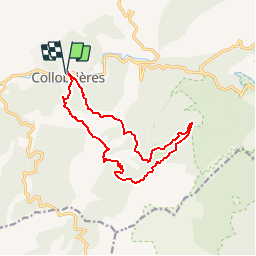

Length
14.2 km

Max alt
517 m

Uphill gradient
544 m
Km-Effort
21 km

Min alt
152 m

Downhill gradient
544 m
Boucle
Yes
Creation date :
2014-12-10 00:00:00.0
Updated on :
2014-12-10 00:00:00.0
4h40
Difficulty : Easy

FREE GPS app for hiking
 SityTrail
IGN / Geographical institutes
SityTrail Plus
The world is yours!
About
Trail Walking of 14.2 km to be discovered at Provence-Alpes-Côte d'Azur, Var, Collobrières. This trail is proposed by frizou83.
Description
Les menhirs du plateau Lambert au départ de Collobrières
Positioning
Country:
France
Region :
Provence-Alpes-Côte d'Azur
Department/Province :
Var
Municipality :
Collobrières
Location:
Unknown
Start:(Dec)
Start:(UTM)
281469 ; 4790771 (32T) N.
Comments
merci