


fournel

ninia
User
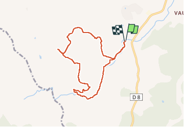

Length
8.5 km

Max alt
205 m

Uphill gradient
199 m
Km-Effort
11.1 km

Min alt
14 m

Downhill gradient
201 m
Boucle
Yes
Creation date :
2023-03-23 07:46:30.404
Updated on :
2023-03-23 10:51:45.254
3h04
Difficulty : Medium

FREE GPS app for hiking
 SityTrail
IGN / Geographical institutes
SityTrail Plus
The world is yours!
About
Trail Walking of 8.5 km to be discovered at Provence-Alpes-Côte d'Azur, Var, Roquebrune-sur-Argens. This trail is proposed by ninia.
Positioning
Country:
France
Region :
Provence-Alpes-Côte d'Azur
Department/Province :
Var
Municipality :
Roquebrune-sur-Argens
Location:
Unknown
Start:(Dec)
Start:(UTM)
311521 ; 4807558 (32T) N.
Comments