


2023-03-23_17h45m29_gr169

daniellebou
User
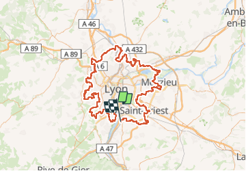

Length
170 km

Max alt
578 m

Uphill gradient
2744 m
Km-Effort
206 km

Min alt
155 m

Downhill gradient
2737 m
Boucle
No
Creation date :
2023-03-23 16:45:33.23
Updated on :
2023-03-23 17:23:07.245
46h54
Difficulty : Very difficult

FREE GPS app for hiking
 SityTrail
IGN / Geographical institutes
SityTrail Plus
The world is yours!
About
Trail Walking of 170 km to be discovered at Auvergne-Rhône-Alpes, Métropole de Lyon, Irigny. This trail is proposed by daniellebou.
Positioning
Country:
France
Region :
Auvergne-Rhône-Alpes
Department/Province :
Métropole de Lyon
Municipality :
Irigny
Location:
Unknown
Start:(Dec)
Start:(UTM)
642636 ; 5061147 (31T) N.
Comments