


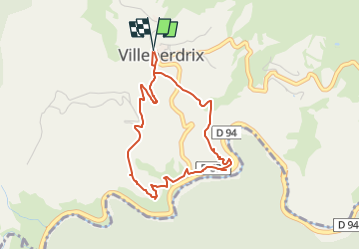
SityTrail - 26 Villeperdrix : sentier des oliviers

phidge
User

Length
3.8 km

Max alt
485 m

Uphill gradient
115 m
Km-Effort
5.4 km

Min alt
392 m

Downhill gradient
110 m
Boucle
Yes
Creation date :
2023-03-25 10:59:55.592
Updated on :
2023-03-25 11:00:33.4
1h13
Difficulty : Easy

FREE GPS app for hiking
 SityTrail
IGN / Geographical institutes
SityTrail Plus
The world is yours!
About
Trail Walking of 3.8 km to be discovered at Auvergne-Rhône-Alpes, Drôme, Villeperdrix. This trail is proposed by phidge.
Description
trés joli sentier permettant de dominer les gorges de Eygues
Positioning
Country:
France
Region :
Auvergne-Rhône-Alpes
Department/Province :
Drôme
Municipality :
Villeperdrix
Location:
Unknown
Start:(Dec)
Start:(UTM)
681945 ; 4923505 (31T) N.
Comments