


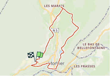
Le Bis - la Source - les Marais

Genisset
User

Length
8.8 km

Max alt
977 m

Uphill gradient
262 m
Km-Effort
12.3 km

Min alt
787 m

Downhill gradient
261 m
Boucle
Yes
Creation date :
2023-03-27 11:46:46.567
Updated on :
2023-03-27 15:56:21.119
2h06
Difficulty : Medium

FREE GPS app for hiking
 SityTrail
IGN / Geographical institutes
SityTrail Plus
The world is yours!
About
Trail Walking of 8.8 km to be discovered at Bourgogne-Franche-Comté, Jura, Morbier. This trail is proposed by Genisset.
Positioning
Country:
France
Region :
Bourgogne-Franche-Comté
Department/Province :
Jura
Municipality :
Morbier
Location:
Unknown
Start:(Dec)
Start:(UTM)
270381 ; 5158076 (32T) N.
Comments
