


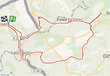
lasauvage/fond de gras

veroberton
User

Length
13.1 km

Max alt
427 m

Uphill gradient
275 m
Km-Effort
16.8 km

Min alt
283 m

Downhill gradient
273 m
Boucle
Yes
Creation date :
2023-03-27 12:32:58.468
Updated on :
2023-03-27 16:18:52.005
3h44
Difficulty : Medium

FREE GPS app for hiking
 SityTrail
IGN / Geographical institutes
SityTrail Plus
The world is yours!
About
Trail Walking of 13.1 km to be discovered at Grand Est, Meurthe-et-Moselle, Saulnes. This trail is proposed by veroberton.
Positioning
Country:
France
Region :
Grand Est
Department/Province :
Meurthe-et-Moselle
Municipality :
Saulnes
Location:
Unknown
Start:(Dec)
Start:(UTM)
704635 ; 5490445 (31U) N.
Comments