


bezonne

bouscaillou
User
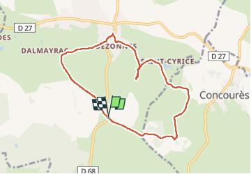

Length
8.2 km

Max alt
613 m

Uphill gradient
91 m
Km-Effort
9.4 km

Min alt
549 m

Downhill gradient
87 m
Boucle
Yes
Creation date :
2023-03-28 12:03:34.089
Updated on :
2023-03-28 14:24:39.791
2h20
Difficulty : Medium

FREE GPS app for hiking
 SityTrail
IGN / Geographical institutes
SityTrail Plus
The world is yours!
About
Trail Walking of 8.2 km to be discovered at Occitania, Aveyron, Rodelle. This trail is proposed by bouscaillou.
Positioning
Country:
France
Region :
Occitania
Department/Province :
Aveyron
Municipality :
Rodelle
Location:
Unknown
Start:(Dec)
Start:(UTM)
470015 ; 4920918 (31T) N.
Comments