


Chagny 22.4km 20230330

cmike39
User
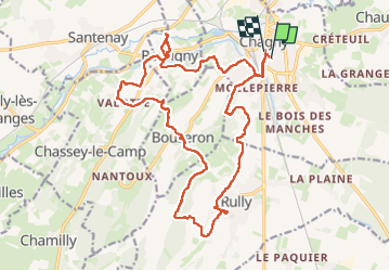

Length
22 km

Max alt
363 m

Uphill gradient
502 m
Km-Effort
29 km

Min alt
208 m

Downhill gradient
509 m
Boucle
No
Creation date :
2023-03-30 07:18:55.836
Updated on :
2023-03-30 15:07:37.543
5h44
Difficulty : Very difficult

FREE GPS app for hiking
 SityTrail
IGN / Geographical institutes
SityTrail Plus
The world is yours!
About
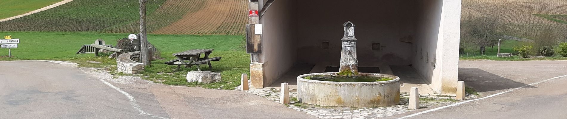
Trail Walking of 22 km to be discovered at Bourgogne-Franche-Comté, Saône-et-Loire, Chagny. This trail is proposed by cmike39.
Photos


Positioning
Country:
France
Region :
Bourgogne-Franche-Comté
Department/Province :
Saône-et-Loire
Municipality :
Chagny
Location:
Unknown
Start:(Dec)
Start:(UTM)
633644 ; 5196296 (31T) N.
Comments