


St_Nectaire_Sapchat_Granges

jagarnier
User GUIDE
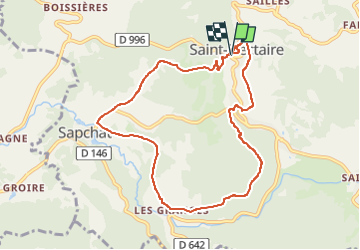

Length
9.1 km

Max alt
819 m

Uphill gradient
283 m
Km-Effort
12.9 km

Min alt
682 m

Downhill gradient
282 m
Boucle
Yes
Creation date :
2023-03-31 10:19:17.234
Updated on :
2024-10-31 06:56:35.505
2h45
Difficulty : Medium

FREE GPS app for hiking
 SityTrail
IGN / Geographical institutes
SityTrail Plus
The world is yours!
About
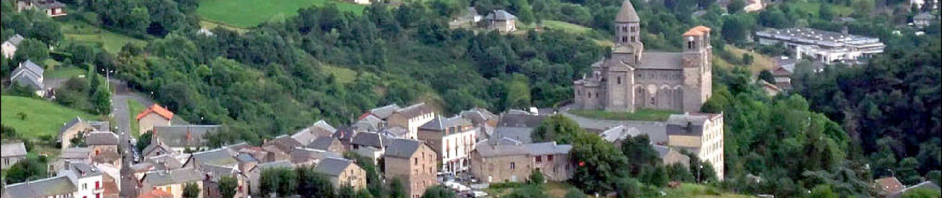
Trail Walking of 9.1 km to be discovered at Auvergne-Rhône-Alpes, Puy-de-Dôme, Saint-Nectaire. This trail is proposed by jagarnier.
Photos

Positioning
Country:
France
Region :
Auvergne-Rhône-Alpes
Department/Province :
Puy-de-Dôme
Municipality :
Saint-Nectaire
Location:
Unknown
Start:(Dec)
Start:(UTM)
499335 ; 5048256 (31T) N.
Comments