


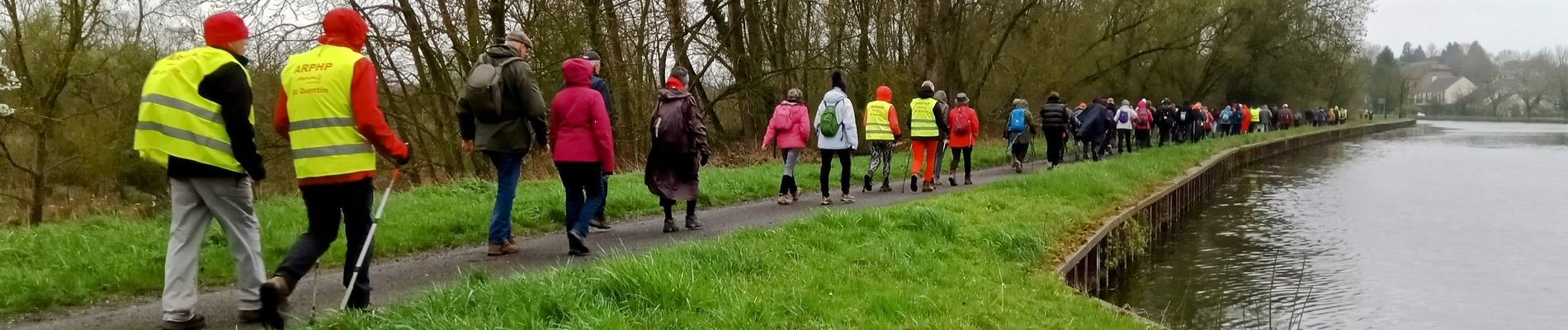
Castres du 02-04-2023 le matin

VANDERPUTTENMi
User GUIDE
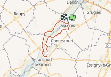

Length
9.5 km

Max alt
85 m

Uphill gradient
71 m
Km-Effort
10.4 km

Min alt
67 m

Downhill gradient
70 m
Boucle
Yes
Creation date :
2023-04-02 07:21:48.142
Updated on :
2023-04-08 18:45:20.101
2h12
Difficulty : Medium

FREE GPS app for hiking
 SityTrail
IGN / Geographical institutes
SityTrail Plus
The world is yours!
About
Trail Walking of 9.5 km to be discovered at Hauts-de-France, Aisne, Castres. This trail is proposed by VANDERPUTTENMi.
Photos

Positioning
Country:
France
Region :
Hauts-de-France
Department/Province :
Aisne
Municipality :
Castres
Location:
Unknown
Start:(Dec)
Start:(UTM)
517170 ; 5516957 (31U) N.
Comments