


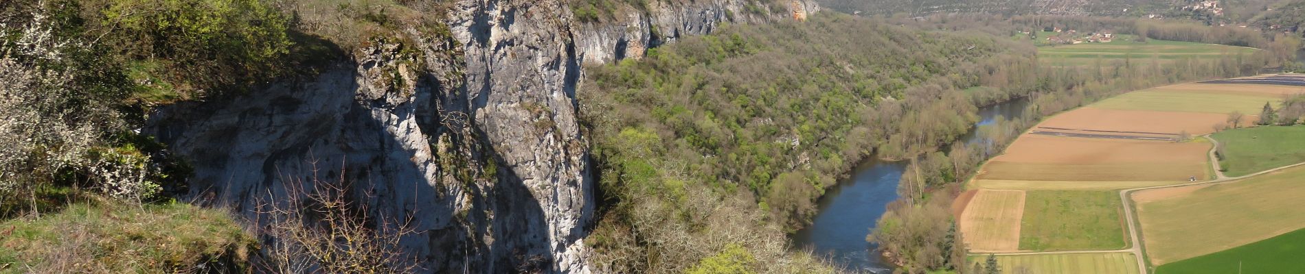
Saujac-Bastides et Gorges de l'Aveyron

houbart
User
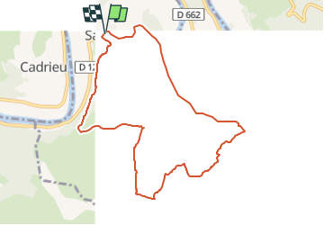

Length
9.7 km

Max alt
321 m

Uphill gradient
246 m
Km-Effort
13 km

Min alt
176 m

Downhill gradient
243 m
Boucle
Yes
Creation date :
2023-04-02 13:55:35.722
Updated on :
2023-04-12 15:33:28.289
2h56
Difficulty : Difficult

FREE GPS app for hiking
 SityTrail
IGN / Geographical institutes
SityTrail Plus
The world is yours!
About
Trail Walking of 9.7 km to be discovered at Occitania, Aveyron, Saujac. This trail is proposed by houbart.
Photos


Positioning
Country:
France
Region :
Occitania
Department/Province :
Aveyron
Municipality :
Saujac
Location:
Unknown
Start:(Dec)
Start:(UTM)
411890 ; 4927571 (31T) N.
Comments