


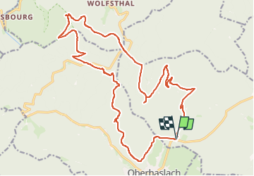
Oberhaslach Pfaffenlapp Schneeberg Hohenstein

holtzv
User GUIDE

Length
23 km

Max alt
956 m

Uphill gradient
807 m
Km-Effort
34 km

Min alt
326 m

Downhill gradient
811 m
Boucle
Yes
Creation date :
2023-04-03 07:19:09.219
Updated on :
2023-04-03 07:20:50.238
0m
Difficulty : Difficult

FREE GPS app for hiking
 SityTrail
IGN / Geographical institutes
SityTrail Plus
The world is yours!
About
Trail Trail of 23 km to be discovered at Grand Est, Bas-Rhin, Still. This trail is proposed by holtzv.
Positioning
Country:
France
Region :
Grand Est
Department/Province :
Bas-Rhin
Municipality :
Still
Location:
Unknown
Start:(Dec)
Start:(UTM)
377573 ; 5380039 (32U) N.
Comments