Trail Walking Clairoix - Randonnée au fort Ganelon ( Clairoix) - Photo

Randonnée au fort Ganelon ( Clairoix)

 dudu42
dudu42

User

© OpenStreetMap contributors
Length
Length
10.5 km
Max alt
Max alt
154 m
Uphill gradient
Uphill gradient
268 m
Km-Effort
Km-Effort  
14 km
Min alt
Min alt
33 m
Downhill gradient
Downhill gradient
268 m
Boucle
Boucle
Yes
Creation date :
2023-04-05 08:58:41.713
Updated on :
2023-04-05 11:47:59.468

(0 Reviews)

Walking
Walking
2h33
Difficulty : Medium

Scan this QR Code to open this trail in the SityTrail application

FREE GPS app for hiking

Logo SityTrail SityTrail

IGN / Geographical institutes

Download SityTrail from the App Store Download SityTrail from Google Play

Logo SityTrail SityTrail World

The world is yours!

Download SityTrail from the App Store Download SityTrail from Google Play Download SityTrail on Huawei AppGallery

About

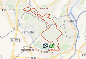
Trail Walking of 10.5 km to be discovered at Hauts-de-France, Oise, Clairoix. This trail is proposed by dudu42.

Description

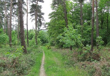
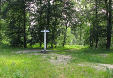
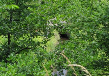
Randonnée dans les bois de feuillus avec le chant des oiseaux ! . Chemin de terre tout au long . Peut être glissant sur les parties pentues par temps humide.

Elevation profile

Photos

30 photos in total. Please click on a photo to see them all in the gallery.

Positioning

Country:
France
Region :
Hauts-de-France
Department/Province :
Oise
Municipality :
Clairoix
Location:
Unknown
Start:(UTM)
488787 ; 5476533 (31U) N.

Trails nearby

Trail Walking Choisy-au-Bac - en forêt de Laigue_9_06_2020_Chemin du Fau Bidaud et la Route de Royaumont - Photo
Walking

Walking

Very difficult
(1)
Choisy-au-Bac, Hauts-de-France, Oise, France
9.6 km | 12.8 km-effort
3h 0min
Yes
Trail Walking Jaux - JAUX, Oise - Photo
Walking
jeannine grandjean

Walking

Medium
Jaux, Hauts-de-France, Oise, France
6.4 km | 7.7 km-effort
1h 45min
Yes
Trail Walking Compiègne - Compiegne rond point de l’Armistice 13,4 km - Photo
Walking
GUIDE
rvapeldo

Walking

Easy
Compiègne, Hauts-de-France, Oise, France
13.4 km | 17.5 km-effort
3h 36min
Yes
Trail Walking Compiègne - en forêt de Compiègne_47_autour des Beaux Monts - Photo
Walking

Walking

Medium
Compiègne, Hauts-de-France, Oise, France
4.8 km | 6.4 km-effort
1h 27min
No
Trail On foot Compiègne - Promenade du Point de Vue des beaux Monts - Photo
On foot
PRO

On foot

Easy
Compiègne, Hauts-de-France, Oise, France
3.1 km | 3.8 km-effort
51min
Yes
Trail Walking Choisy-au-Bac - en forêt de Laigue_14_05_2021_les Chemins du Plessis-Brion et de la Voie de l'Eau - Photo
Walking

Walking

Very difficult
Choisy-au-Bac, Hauts-de-France, Oise, France
10.3 km | 12.9 km-effort
3h 30min
Yes
Trail Walking Choisy-au-Bac - en forêt de Laigue_12_05_2021_sur le Mont Renard et le Mont l'Ecange - Photo
Walking

Walking

Very difficult
Choisy-au-Bac, Hauts-de-France, Oise, France
12.1 km | 15.5 km-effort
4h 45min
Yes
Trail On foot Compiègne - en forêt de Compiègne_34_autour du Buissonnet et du Berne - Photo
On foot

On foot

Very difficult
Compiègne, Hauts-de-France, Oise, France
17.5 km | 20 km-effort
Unknown
Yes
Trail Walking Choisy-au-Bac - La rando des 3 étangs - Photo
Walking
pascha

Walking

(1)
Choisy-au-Bac, Hauts-de-France, Oise, France
11.4 km | 13.3 km-effort
2h 34min
Yes


Close
My subscriptions