


PR_56_Bignan_AA_01_Les-Landes_Circuit1b20230405

patrickdanilo
User
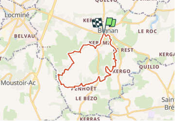

Length
14.1 km

Max alt
180 m

Uphill gradient
280 m
Km-Effort
17.9 km

Min alt
84 m

Downhill gradient
282 m
Boucle
Yes
Creation date :
2023-04-05 08:04:16.368
Updated on :
2025-07-25 14:36:00.31
3h06
Difficulty : Easy

FREE GPS app for hiking
 SityTrail
IGN / Geographical institutes
SityTrail Plus
The world is yours!
About
Trail Walking of 14.1 km to be discovered at Brittany, Morbihan, Bignan. This trail is proposed by patrickdanilo.
Description
Randonnée Marche de 14,1 km à découvrir à Bretagne, Morbihan, Bignan. Cette randonnée est proposée par patrickdanilo.
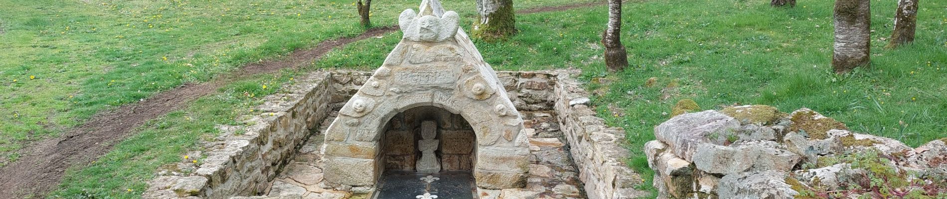
Photos


Positioning
Country:
France
Region :
Brittany
Department/Province :
Morbihan
Municipality :
Bignan
Location:
Unknown
Start:(Dec)
Start:(UTM)
516856 ; 5302833 (30T) N.
Comments