


ITILAR048V50A8T3

sdroneau
User
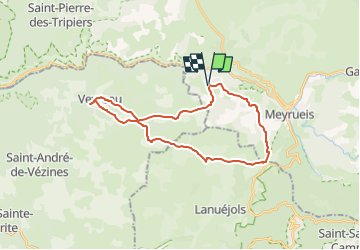

Length
28 km

Max alt
1047 m

Uphill gradient
517 m
Km-Effort
35 km

Min alt
851 m

Downhill gradient
515 m
Boucle
Yes
Creation date :
2023-04-05 12:27:38.292
Updated on :
2023-04-05 12:51:01.443
2h24
Difficulty : Difficult

FREE GPS app for hiking
 SityTrail
IGN / Geographical institutes
SityTrail Plus
The world is yours!
About
Trail Mountain bike of 28 km to be discovered at Occitania, Lozère, Meyrueis. This trail is proposed by sdroneau.


Positioning
Country:
France
Region :
Occitania
Department/Province :
Lozère
Municipality :
Meyrueis
Location:
Unknown
Start:(Dec)
Start:(UTM)
529947 ; 4893215 (31T) N.
Comments