Trail Walking Saint-Prest - St prèst>> Soulaires>>jouy >> St prest  - Photo

St prèst>> Soulaires>>jouy >> St prest

 ezola
ezola

User

© OpenStreetMap contributors
Length
Length
21 km
Max alt
Max alt
155 m
Uphill gradient
Uphill gradient
227 m
Km-Effort
Km-Effort  
24 km
Min alt
Min alt
110 m
Downhill gradient
Downhill gradient
227 m
Boucle
Boucle
Yes
Creation date :
2023-04-05 08:34:15.0
Updated on :
2023-04-05 14:28:15.314

(0 Reviews)

Walking
Walking
4h46
Difficulty : Very difficult

Scan this QR Code to open this trail in the SityTrail application

FREE GPS app for hiking

Logo SityTrail SityTrail

IGN / Geographical institutes

Download SityTrail from the App Store Download SityTrail from Google Play

Logo SityTrail SityTrail World

The world is yours!

Download SityTrail from the App Store Download SityTrail from Google Play Download SityTrail on Huawei AppGallery

About

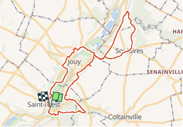
Trail Walking of 21 km to be discovered at Centre-Loire Valley, Eure-et-Loir, Saint-Prest. This trail is proposed by ezola.

Description

Repas grange, Soulaires

Elevation profile

Photos

Positioning

Country:
France
Region :
Centre-Loire Valley
Department/Province :
Eure-et-Loir
Municipality :
Saint-Prest
Location:
Unknown
Start:(UTM)
391679 ; 5371915 (31U) N.

Trails nearby

Trail Walking Chartres - balade autour cathédrale de Chartres  - Photo
Walking
apa

Walking

Easy
Chartres, Centre-Loire Valley, Eure-et-Loir, France
5.3 km | 6.1 km-effort
2h 31min
Yes
Trail Walking Gasville-Oisème - proj 2020_20190716Oiseme - Photo
Walking
Jeanclaudebic

Walking

Very easy
(1)
Gasville-Oisème, Centre-Loire Valley, Eure-et-Loir, France
10.8 km | 12.7 km-effort
2h 35min
Yes
Trail Walking Soulaires - Soulaires, Saint Piat  - Photo
Walking
galou29

Walking

Very easy
Soulaires, Centre-Loire Valley, Eure-et-Loir, France
13.8 km | 16.5 km-effort
3h 17min
No
Trail Mountain bike Mainvilliers - Les planeurs de la base des planeurs d''Armenonville - Chartres - Photo
Mountain bike
tracegps

Mountain bike

Medium
(1)
Mainvilliers, Centre-Loire Valley, Eure-et-Loir, France
53 km | 60 km-effort
4h 0min
Yes
Trail Walking Chartres - 2023 Chartres tour de ville  - Photo
Walking
jctbis

Walking

Easy
Chartres, Centre-Loire Valley, Eure-et-Loir, France
11.3 km | 12.4 km-effort
1h 58min
Yes
Trail Walking Jouy - GB Jouy - Photo
Walking
jctbis

Walking

Easy
Jouy, Centre-Loire Valley, Eure-et-Loir, France
10.2 km | 12.4 km-effort
2h 36min
Yes
Trail Nordic walking Chartres - Chartres Stade GP vers St prest  - Photo
Nordic walking
jctbis

Nordic walking

Easy
Chartres, Centre-Loire Valley, Eure-et-Loir, France
12.9 km | 14.4 km-effort
2h 27min
Yes
Trail Walking Chartres - Chartres est/place drouaise  - Photo
Walking
jctbis

Walking

Easy
Chartres, Centre-Loire Valley, Eure-et-Loir, France
3.8 km | 4.2 km-effort
42min
No
Trail Walking Chartres - Le tour de Chartres  - Photo
Walking
jctbis

Walking

Easy
Chartres, Centre-Loire Valley, Eure-et-Loir, France
11.6 km | 12.9 km-effort
2h 20min
Yes


Close
My subscriptions