


Livradois Forez 5

cron
User
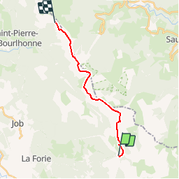

Length
14.4 km

Max alt
1609 m

Uphill gradient
382 m
Km-Effort
19.4 km

Min alt
1364 m

Downhill gradient
356 m
Boucle
No
Creation date :
2015-04-08 00:00:00.0
Updated on :
2015-04-08 00:00:00.0
4h08
Difficulty : Medium

FREE GPS app for hiking
 SityTrail
IGN / Geographical institutes
SityTrail Plus
The world is yours!
About
Trail Walking of 14.4 km to be discovered at Auvergne-Rhône-Alpes, Puy-de-Dôme, Valcivières. This trail is proposed by cron.
Positioning
Country:
France
Region :
Auvergne-Rhône-Alpes
Department/Province :
Puy-de-Dôme
Municipality :
Valcivières
Location:
Unknown
Start:(Dec)
Start:(UTM)
565865 ; 5049244 (31T) N.
Comments