


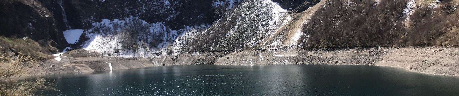
Lac d’Oo

PascalBanide
User
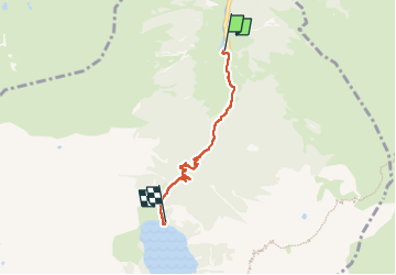

Length
4.3 km

Max alt
1537 m

Uphill gradient
447 m
Km-Effort
9 km

Min alt
1128 m

Downhill gradient
64 m
Boucle
No
Creation date :
2023-04-09 09:41:15.0
Updated on :
2023-04-09 13:23:44.894
2h05
Difficulty : Medium

FREE GPS app for hiking
 SityTrail
IGN / Geographical institutes
SityTrail Plus
The world is yours!
About
Trail Walking of 4.3 km to be discovered at Occitania, Haute-Garonne, Oô. This trail is proposed by PascalBanide.
Photos

Positioning
Country:
France
Region :
Occitania
Department/Province :
Haute-Garonne
Municipality :
Oô
Location:
Unknown
Start:(Dec)
Start:(UTM)
295546 ; 4737650 (31T) N.
Comments