


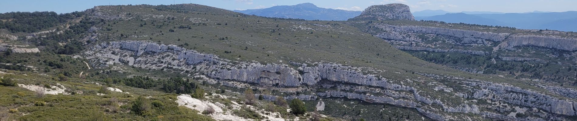
le pic du Taoumé par Pichauris

amiral13
User GUIDE
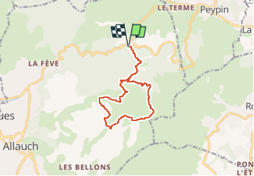

Length
13.3 km

Max alt
689 m

Uphill gradient
507 m
Km-Effort
20 km

Min alt
309 m

Downhill gradient
507 m
Boucle
Yes
Creation date :
2023-04-09 08:54:25.565
Updated on :
2023-04-11 06:12:45.488
4h32
Difficulty : Easy

FREE GPS app for hiking
 SityTrail
IGN / Geographical institutes
SityTrail Plus
The world is yours!
About
Trail Walking of 13.3 km to be discovered at Provence-Alpes-Côte d'Azur, Bouches-du-Rhône, Allauch. This trail is proposed by amiral13.
Description
un beau point de vue.
La baume Sourne n'est plus accessible afin de protéger une espèce de chauve-souris.
La plupart des sources sont à sec.
Photos


Positioning
Country:
France
Region :
Provence-Alpes-Côte d'Azur
Department/Province :
Bouches-du-Rhône
Municipality :
Allauch
Location:
Unknown
Start:(Dec)
Start:(UTM)
705467 ; 4805070 (31T) N.
Comments