


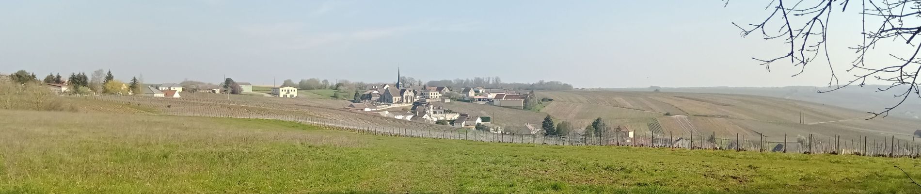
Congy du 09/04/2023

VANDERPUTTENMi
User GUIDE
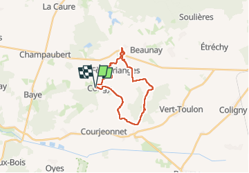

Length
19.8 km

Max alt
241 m

Uphill gradient
285 m
Km-Effort
24 km

Min alt
143 m

Downhill gradient
286 m
Boucle
Yes
Creation date :
2023-04-09 08:12:03.914
Updated on :
2023-04-09 17:28:00.142
5h21
Difficulty : Very difficult

FREE GPS app for hiking
 SityTrail
IGN / Geographical institutes
SityTrail Plus
The world is yours!
About
Trail Walking of 19.8 km to be discovered at Grand Est, Marne, Congy. This trail is proposed by VANDERPUTTENMi.
Description
Congy - Etoges - Toulon la Montagne par le GRP° Thibaut de Champagne...
Photos

Positioning
Country:
France
Region :
Grand Est
Department/Province :
Marne
Municipality :
Congy
Location:
Unknown
Start:(Dec)
Start:(UTM)
560631 ; 5412076 (31U) N.
Comments