


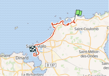
GR_34_AE_05_St-Coulomb_St-Malo_20230409

patrickdanilo
User


5h07
Difficulty : Easy

FREE GPS app for hiking
 SityTrail
IGN / Geographical institutes
SityTrail Plus
The world is yours!
About
Trail Walking of 19.5 km to be discovered at Brittany, Ille-et-Vilaine, Saint-Coulomb. This trail is proposed by patrickdanilo.
Description
Randonnée Marche de 19,5 km à découvrir à Bretagne, Ille-et-Vilaine, Saint-Coulomb. Cette randonnée est proposée par patrickdanilo.
Photos


29 photos in total. Please click on a photo to see them all in the gallery.
Positioning
Comments