


passerelle de monteynard (treffort)

bubufred
User

Length
17.3 km

Max alt
692 m

Uphill gradient
517 m
Km-Effort
24 km

Min alt
470 m

Downhill gradient
517 m
Boucle
Yes
Creation date :
2023-04-09 09:52:40.673
Updated on :
2023-04-09 15:12:17.764
4h00
Difficulty : Very difficult

FREE GPS app for hiking
 SityTrail
IGN / Geographical institutes
SityTrail Plus
The world is yours!
About
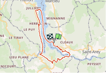
Trail Walking of 17.3 km to be discovered at Auvergne-Rhône-Alpes, Isère, Mayres-Savel. This trail is proposed by bubufred.
Positioning
Country:
France
Region :
Auvergne-Rhône-Alpes
Department/Province :
Isère
Municipality :
Mayres-Savel
Location:
Unknown
Start:(Dec)
Start:(UTM)
712516 ; 4973079 (31T) N.
Comments