


Pâques 2023

apa
User

Length
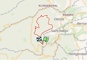
10.5 km

Max alt
735 m

Uphill gradient
369 m
Km-Effort
15.5 km

Min alt
475 m

Downhill gradient
373 m
Boucle
Yes
Creation date :
2023-04-10 09:06:16.0
Updated on :
2023-04-10 13:22:50.156

FREE GPS app for hiking
 SityTrail
IGN / Geographical institutes
SityTrail Plus
The world is yours!
About
Trail of 10.5 km to be discovered at Grand Est, Bas-Rhin, Ottrott. This trail is proposed by apa.
Photos


Positioning
Country:
France
Region :
Grand Est
Department/Province :
Bas-Rhin
Municipality :
Ottrott
Location:
Unknown
Start:(Dec)
Start:(UTM)
381638 ; 5365640 (32U) N.
Comments