


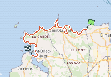
GR_34_BA_07_Dinard_Lancieux_20230411

patrickdanilo
User

Length
14 km

Max alt
39 m

Uphill gradient
207 m
Km-Effort
16.7 km

Min alt
-1 m

Downhill gradient
209 m
Boucle
No
Creation date :
2023-04-11 07:44:47.083
Updated on :
2023-04-14 13:59:34.345
3h48
Difficulty : Difficult

FREE GPS app for hiking
 SityTrail
IGN / Geographical institutes
SityTrail Plus
The world is yours!
About
Trail Walking of 14 km to be discovered at Brittany, Ille-et-Vilaine, Dinard. This trail is proposed by patrickdanilo.
Description
Randonnée Marche de 14,1 km à découvrir à Bretagne, Ille-et-Vilaine, Dinard. Cette randonnée est proposée par patrickdanilo.
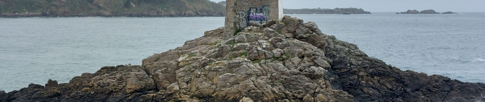
Photos


Positioning
Country:
France
Region :
Brittany
Department/Province :
Ille-et-Vilaine
Municipality :
Dinard
Location:
Unknown
Start:(Dec)
Start:(UTM)
567752 ; 5387441 (30U) N.
Comments