


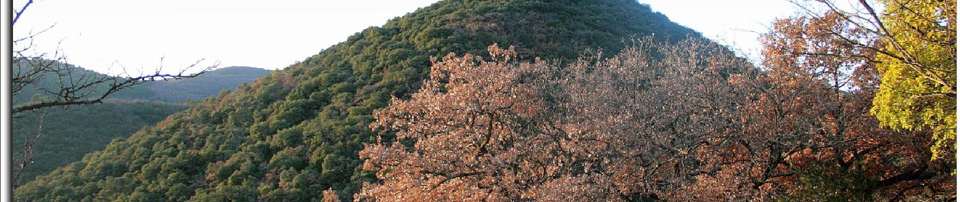
2023-04-11_13h48m56_t255726869_nb rochemaure la

chancha
User GUIDE
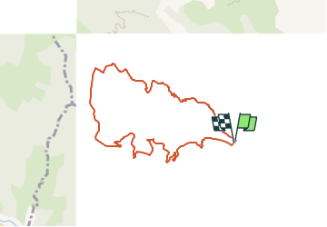

Length
8.6 km

Max alt
439 m

Uphill gradient
347 m
Km-Effort
13.2 km

Min alt
118 m

Downhill gradient
344 m
Boucle
Yes
Creation date :
2023-04-11 11:48:57.812
Updated on :
2023-04-13 08:10:06.267
2h59
Difficulty : Difficult

FREE GPS app for hiking
 SityTrail
IGN / Geographical institutes
SityTrail Plus
The world is yours!
About
Trail Walking of 8.6 km to be discovered at Auvergne-Rhône-Alpes, Ardèche, Rochemaure. This trail is proposed by chancha.
Photos


Positioning
Country:
France
Region :
Auvergne-Rhône-Alpes
Department/Province :
Ardèche
Municipality :
Rochemaure
Location:
Unknown
Start:(Dec)
Start:(UTM)
634040 ; 4937202 (31T) N.
Comments