


Cresta

ajd26
User
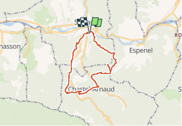

Length
14 km

Max alt
888 m

Uphill gradient
1001 m
Km-Effort
27 km

Min alt
274 m

Downhill gradient
1000 m
Boucle
Yes
Creation date :
2023-04-13 06:31:14.0
Updated on :
2023-04-14 08:25:45.829
6h12
Difficulty : Very difficult

FREE GPS app for hiking
 SityTrail
IGN / Geographical institutes
SityTrail Plus
The world is yours!
About
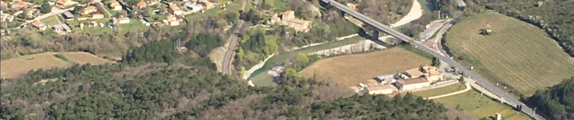
Trail Walking of 14 km to be discovered at Auvergne-Rhône-Alpes, Drôme, Saillans. This trail is proposed by ajd26.
Description
départ de Saillans
beaux panoramas avec un accès au sommet où il faut mettre les mains
retour par le GR9 très agréable
Photos


Positioning
Country:
France
Region :
Auvergne-Rhône-Alpes
Department/Province :
Drôme
Municipality :
Saillans
Location:
Unknown
Start:(Dec)
Start:(UTM)
674322 ; 4951078 (31T) N.
Comments