


PR_56_Ile-Aux-Moines_AA_01_Le-Tour-De-L-Ile-Aux-Moines_Circuit1b_20230415

patrickdanilo
User
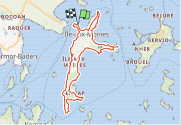

Length
19.7 km

Max alt
25 m

Uphill gradient
177 m
Km-Effort
22 km

Min alt
0 m

Downhill gradient
181 m
Boucle
Yes
Creation date :
2023-04-15 08:13:04.782
Updated on :
2025-07-28 11:34:18.322
5h01
Difficulty : Very difficult

FREE GPS app for hiking
 SityTrail
IGN / Geographical institutes
SityTrail Plus
The world is yours!
About
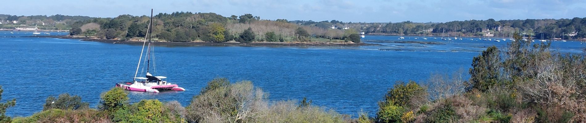
Trail Walking of 19.7 km to be discovered at Brittany, Morbihan, Île-aux-Moines. This trail is proposed by patrickdanilo.
Description
Randonnée Marche de 19,6 km à découvrir à Bretagne, Morbihan, Île-aux-Moines. Cette randonnée est proposée par patrickdanilo.
Photos


Positioning
Country:
France
Region :
Brittany
Department/Province :
Morbihan
Municipality :
Île-aux-Moines
Location:
Unknown
Start:(Dec)
Start:(UTM)
511137 ; 5271941 (30T) N.
Comments