


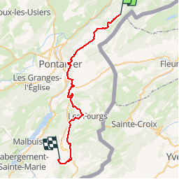

64 km | 88 km-effort


User


FREE GPS app for hiking
 SityTrail
IGN / Geographical institutes
SityTrail World
The world is yours!
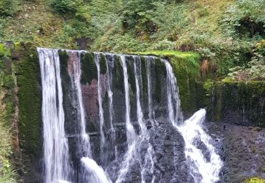
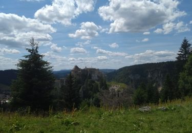
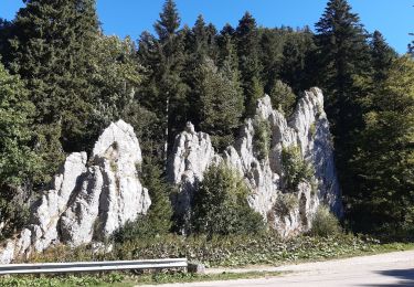
Trail Mountain bike of 39 km to be discovered at Bourgogne-Franche-Comté, Doubs, Hauterive-la-Fresse. This trail is proposed by geoja.


Mountain bike
Walking

Horseback riding

Mountain bike
Walking

Walking
Walking
Walking
Walking